
View Map
List of Communities
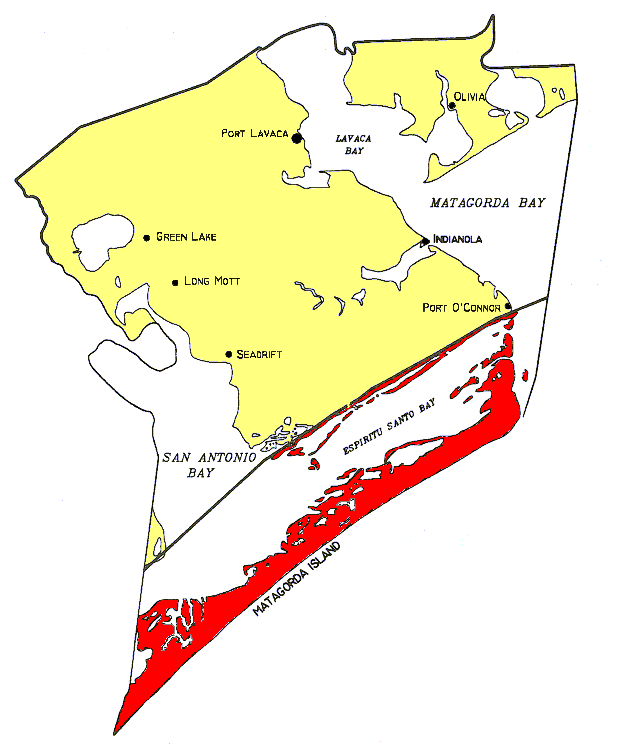
Description of Dividing Line
View a complete list of all Appointed Engineers and the types of inspections that they perform in our windstorm system.
Please note that these engineers may not perform post-construction inspections for every type of certification (entire structure, addition, alteration, repair or re-roof).

This product is for informational purposes and is not prepared for or suitable for legal, engineering, or surveying purposes. It does not represent an on-the-ground survey and represents only the approximate relative location of property boundaries.
The Texas Department of Insurance produces maps for general informational use only. No warranty is made by TDI regarding specific accuracy or completeness. It is the user's responsibility to verify all data represented in the maps.
List of Communities
The following is a list of communities located in Calhoun County. The communities have been categorized according to the zone they fall under. If a structure is located in a community or area not shown below, then refer to the county map to determine which zone the structure falls under.
INLAND I- 2006 IBC/IRC with the Texas Revisions, 120 mph 3-second gust design wind speed
| Alamo Beach | Clarks |
| Green Lake | Heyser |
| Indianola | Kamey |
| Long Mott | Magnolia Beach |
| North Seadrift | Olivia |
| Point Comfort | Port Alto |
| Port Lavaca | Port O'Conner |
| Schicke Point | Seadrift |
| Sixmile | |
Written Description of Dividing Line Between Inland I and Inland II Zones:
Calhoun County:
Beginning at the Refugio/Victoria County line intersection with U.S. Highway 77 and continuing east along the Refugio County line to the intersection with the Calhoun County line and following north and east along the Calhoun County line to the intersection of the Calhoun/Matagorda County line.